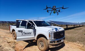
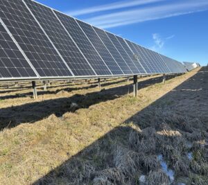
Allen Engineering and Science, Inc. is committed to leveraging cutting-edge technology to tackle complex environmental challenges. One of our current projects involves developing an erosion control plan for a solar farm, and we’d like to share how our advanced LiDAR drone is playing a crucial role in this process.
What is LiDAR?
LiDAR (Light Detection and Ranging) is a remote sensing method that uses light to measure variable distances to bare ground. This technology is incredibly effective in mapping areas with thick vegetation or other obstructions that make traditional data collection methods difficult.
How AllenES Uses LiDAR
In this project, our LiDAR drone is being used to collect and map topographic elevation data, providing detailed data on the extent of erosion and the flow of water across the land. This information is invaluable for our civil engineers as they develop strategies to mitigate erosion and ensure the sustainability of the solar farm.
AllenES Capabilities
Our LiDAR drone is regularly deployed across various projects within our company, demonstrating its versatility and effectiveness in different environments. Whether it’s dense forests, rugged terrains, or urban landscapes, our LiDAR technology provides precise and comprehensive data that informs our engineering solutions.
By integrating advanced technologies like LiDAR into our projects, we are able to deliver efficient, innovative and sustainable solutions that address environmental challenges head-on.
Stay tuned for more insights and updates on our projects!